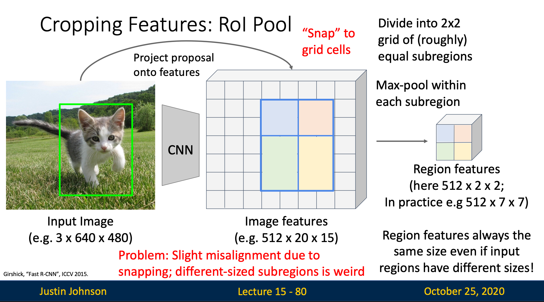
RoI Pooling
Steps
- Mapping RoIs to feature maps: The RoI coordinates (originally in image space) are mapped to the feature map space by dividing by the stride of the network
- Quantization: The mapped coordinates are quantized (rounded) to discrete feature map locations
- Subdivision: Each RoI is divided into a fixed grid (e.g., 7×7 bins)
- Max pooling: Within each bin, max pooling is performed to extract a single value
Quantization Errors (Misalignment)
- When mapping from image coordinates to feature map coordinates, rounding introduces spatial misalignment
- The quantized RoI boundaries may not accurately represent the original object boundaries
- This leads to a “coarse” representation that loses spatial precision
Backpropagation Error
Since we snap the coordinate to integers, we are not able to backprop to the original bounded box coordinate in backward pass